
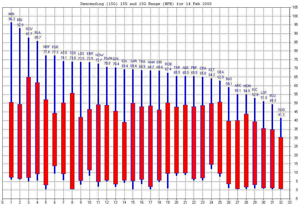
| Maximum Wind Gust | This graphic shows the maximum wind gust (blue line) and the maximum sustained five-minute wind average (red box) for each mesonet station. The three letter station identifiers are described here. (Note: data from the Dubois station is not included because the storm damaged this station.) |
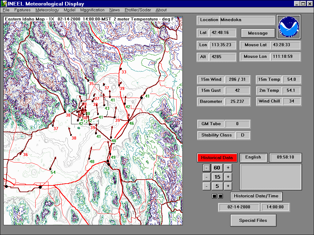
| Air Temperature Field | This animated graphic shows both the wind and the air temerature response as the storm moved from west to east, as shown on INL Mesonet. The time step is every 15 minutes from 1400 through 1700 hours MST. |
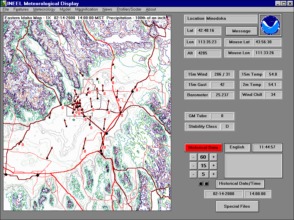
| Precipitation Field | This animated graphic shows both the wind and precipitation response as the storm moved from west to east, as shown on INL Mesonet. The time step is every 15 minutes from 1400 through 1700 hours MST. |