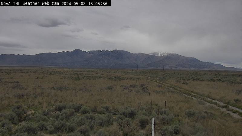

Kettle Butte (West View)

Kettle Butte (East view)

Telegraph Hill (East view)

Telegraph Hill (West view)

INL Puzzle (West view)

INL Puzzle (South view)

INL Puzzle (East view)

Craters NP (South view)

Craters NP (SW view)

Timmerman Hill (North view)

Junction 33/22 - 19 miles West of Mud Lake (NE view)

Junction 33/22 - 19 miles West of Mud Lake (North view)

Tilden Flats (West View)

Tilden Flats (SW View)

Lone Pine (NW View)

Lone Pine (SW View)

Gilmore Summit (South View)

Gilmore Summit (North View)

Monida Pass (SE View)

Monida Pass (North View)

Camp Creek (SW View)

Camp Creek (NW View)

China Point (North View)

China Point (West View)

Camas (NW View)

Camas (SW view)

Sage Junction (SE View)

Sage Junction (NE View)

Osgood/Roberts

Osgood (North View)

Osgood (South view)

Idaho Falls (I-15 at Highway 20)

Idaho Falls (Highway 20 at I15)

Idaho Falls (Downtown Falls)

Idaho Falls (West view)

Blackfoot Rest Area (NE View)

Blackfoot Rest Area (NW view)

Fort Hall (East view)

Fort Hall (SE view)

Pocatello (view to NE)

Pocatello (view to East)

Pocatello (view to South)

McCammon (North View)

McCammon (South View)

Marsh Valley (North View)

Marsh Valley (South View)

Malad Summit (SE View)

Malad Summit (NE View)

Samaria (North view)

Samaria (SW View)

UT/ID State Line

US 20 Ucon (South View)

US 20 Ucon (North View)

Thornton (Southwest View)

Thornton (North View)

Rexburg (North View)

Fall River - 5 miles W of Ashton (NE View)

Fall River - 5 miles W of Ashton (SE View)

Ririe (West View)

Ririe (East View)

Antelope Hill (NW view)

Antelope Hill (SE view)

Sheep Falls (North View)

Sheep Falls (South View)

Osborne Bridge (North View)

Osborne Bridge (SW View)

Henry's Lake Flat (South View)

Henry's Lake Flat (North View)

Newdale/Tetonia at Botts (NE view)

Newdale/Tetonia at Botts (NW view)

ID 33 - River Rim (East view)

ID 33 - River Rim (West view)

Driggs (view toward Targhee and Tetons)

ID 33 - ID/WY Stateline (West view)

ID 33 - ID/WY Stateline (Pavement)

ID 33 - ID/WY Stateline (East view)

Teton Pass, WY (East view)

Teton Pass, WY (West view)

Jackson Hole, WY (East view)

Alpine, WY (North View)

Alpine, WY (East View)

Alpine, WY (South View)

ID 31 (Pine Creek Pass - West View)

ID 31 (Pine Creek Pass - East View)

Sterling (view to NW)

Arbon Valley (view to North)

Arbon Valley (view to NE)

Cold Water (NE View)

Cold Water (NW View)

Raft River (NW View)

Raft River (NE View)

3 M West of Lava Hot Springs (NW View)

3 M West of Lava Hot Springs (NE View)

Fish Creek Summit (North View)

Fish Creek Summit (South View)

Gem Valley (East View)

Gem Valley (West View)

Swan Lake (7 miles South of Downey)

Burley (view to north)

Burley (view to east)

Twin Falls

|
Dept. of Commerce | NOAA | NOAA Research | ARL | FRD Privacy | Disclaimer | Information Quality | webmaster |